
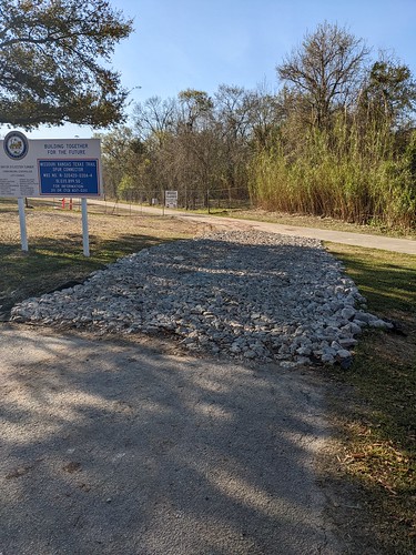
I drive by the construction work being done to extend the White Oak bike trail so that it connects to the Heights bike trail on the north side of the MKT Bridge. I’ve been keeping an eye on its progress and occasionally taking some pictures to document it – see here for the previous update, about a month ago. Here’s what I saw in mid-March:

Most of the work appears to have been done to the side of where the actual trail is – see the second photo in the link above for comparison. That became even more apparent two weeks later, when I took this picture:

I don’t honestly know what’s going on to the right of the trail-to-be. My daughter and I were speculating about it when I pointed it out to her, but neither of us came up with something that sounded plausible to me. I assume it will become evident at some point, but for now I’m scratching my head.
Meanwhile, for that closer view in the back, where that little culvert is:

That part is surely an extension of the bayou, perhaps to make it slightly less likely that Studemont will flood out at the I-10 underpass. I’m just guessing here. It’s not a lot of capacity if that is what it is, but I suppose every little bit helps. Note that the dug-out stuff next to the trail is above where this is.
One more thing, on the side where the Height bike trail approaches the MKT Bridge, coming from White Oak Drive. There has never been an official entry point to the trail from the neighborhood there. You can access it from White Oak Drive, or from where the trail crosses Oxford Street next to White Oak, where the Golden Bagel shop had been, but if you’re approaching the trail from the east side of Studewood, which is to say from the Woodland Heights, that’s some extra redundant distance to go if what you want to do is go towards downtown, maybe using the trail to get to Target or something else in that area. I spotted this in mid-March while out on a Sunday dog walk:
That is what I figure will soon be if it isn’t already a paved connection from Frasier Street to the Heights bike trail, making this the closest entry point to the trail from the Woodland Heights that doesn’t involve biking on Studewood itself (you can access the trail from the little parking lot they put in just north of I-10) or on Watson/Taylor, which requires dodging traffic that’s trying to enter I-10. It’s the closest point that I personally feel safe using to access, in other words. We didn’t need this bit of pavement to get there, but this not only makes it easier when it’s been raining and you now get to avoid biking over mud, it also just seems more inviting, like there’s finally recognition that someone would want to do this. Whatever the motivation, I approve.
I’ll post another update as merited. Still no evidence that the bridge itself is being repaired, which remains a source of frustration. But at least this is making progress.