
Japanese flood tunnel
With engineers working at a feverish pace to get more than 200 projects in its $2.5 billion bond program moving, much of the Flood Control District’s efforts are focused on nuts-and-bolts improvements — including widening bayous, digging detention basins and purchasing flood prone homes.
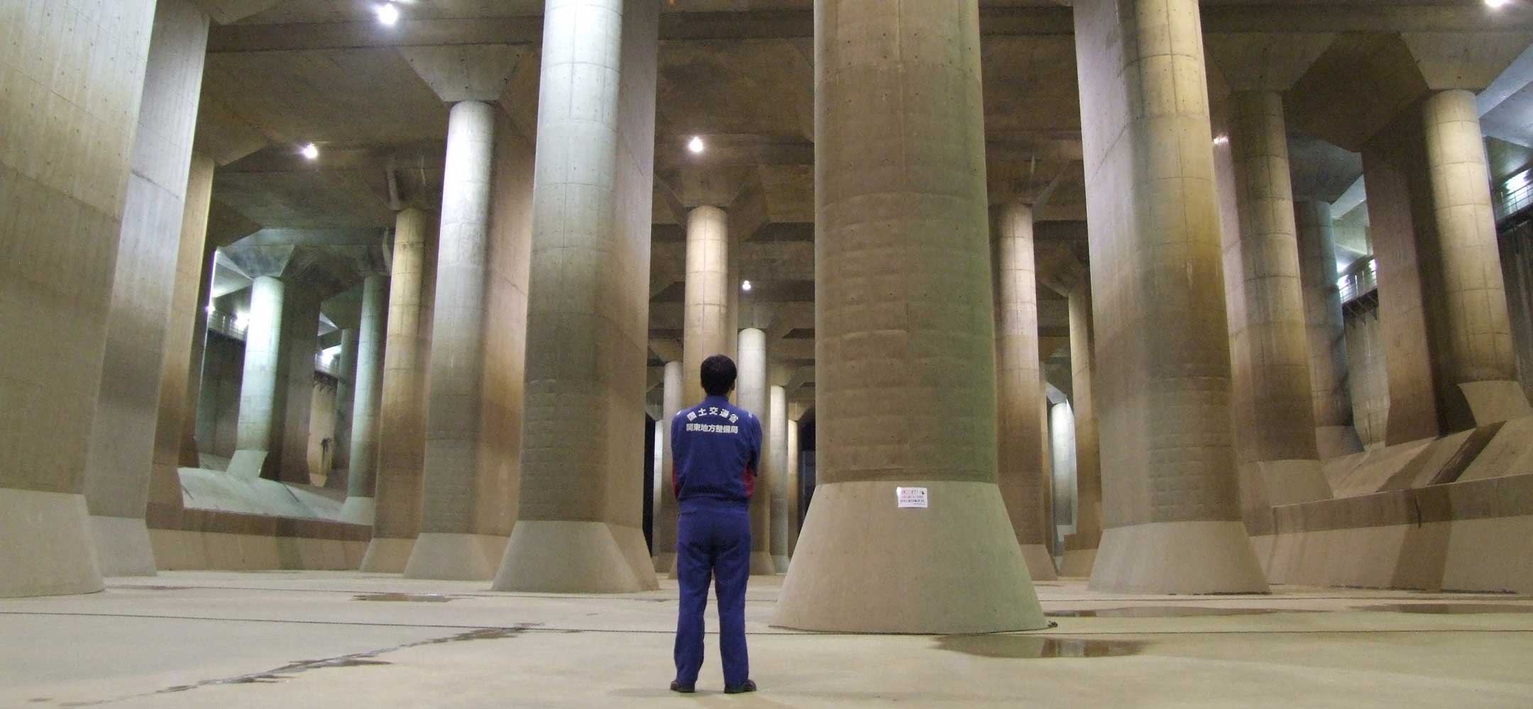
From his cramped office at district headquarters, however, engineer Scott Elmer is pursuing the most ambitious project the agency has ever conceived: massive tunnels that could funnel stormwater beneath the region’s bayou network to the Houston Ship Channel.
The tunnels could provide a crucial new tool to complement existing flood control methods, as new development in fast-growing Harris County and more intense storms wrought by climate change place additional pressure on infrastructure.
“When you look at events such as Hurricane Harvey and Tropical Storm Imelda, it’s time for that type of out-of-the-box thinking,” Elmer said.
The flood control district has considered tunnels since the 1990s, though plans have never advanced beyond paper. Since Harvey in 2017, which flooded more than 200,000 county residences and damaged many of the district’s defenses, the county has revisited the idea.
A study engineers completed in October reached two important conclusions — that tunnels feasibly could be constructed and they could move substantial amounts of stormwater that otherwise could pool in neighborhoods or push bayous over their banks. Encouraged by the results, the district has begun a second phase of research, which over the next year will map one to five possible routes. A third one-year phase would include a geotechnical analysis to evaluate construction challenges.
[…]
Experts also offer cautious approval. Jim Blackburn, co-director of the Severe Storm Prediction, Education, and Evacuation from Disasters Center at Rice University, long has urged Harris County to more aggressively approach flood control. Tunnels are a bold idea, he said, so long as they do not exacerbate flooding downstream.
“What I’m concerned about is that in an effort to keep the cost down, they may attempt to terminate it in an area that may already be congested, from a water standpoint,” Blackburn said.
See here and here for the background. I assume this is the result of the study funded by a federal grant that was approved in February. Cost is an issue, though we can try for federal funds and the tunnels can be built in stages. This would just be one piece of an overall strategy, not the entire approach. No other place that has flood tunnels sees the kind of rainfall Houston does, so it’s hard to model an approach after an existing system. There’s more to it than all this, so go read the rest. It seems like a good idea to pursue, but we’re a long way from starting to dig.
they should be looking at some sort of retention also, no?
My friends from Netherlands can’t understand how one minute we’re rushing water out to sea and the next we are crying there is a drought and we have no water
Houston is roughly 50-80′ above sea level (depending on who you believe). If your plan is to place a tunnel underground from, say, the Barker Cypress area to the Ship Channel, you’re going to have a bit of a slope problem. ‘Bout the only solution would be to have a bank of pumps ala NOLA, but you still have the same problem – you’re dumping your excess (hurricane or tropical storm) rainwater right where it’s going to be wind-blown right back in the factories and residences in the Ship Channel area, and serve as a plug for the rest of the waters flowing the rest of the watershed.